SEJA BEM-VINDO / WELCOME !
Introdução
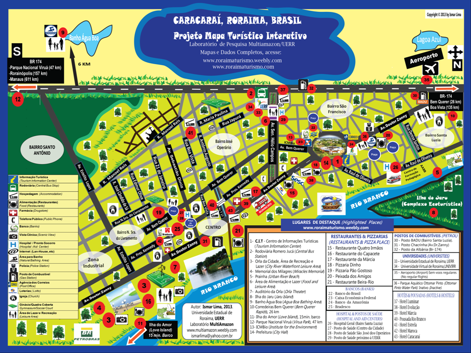
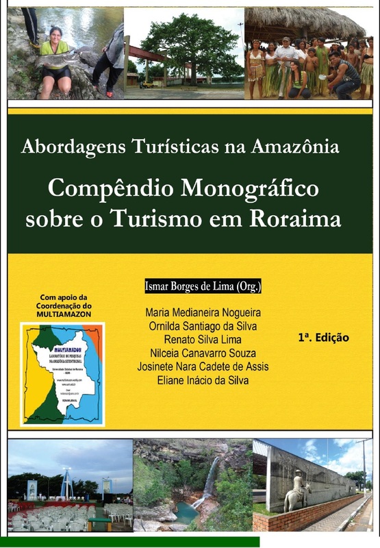
Este Projeto de extensão está sendo desenvolvido pelo Prof. Ismar Lima, um dos coordenadores do Laboratório de Pesquisa em Dinâmicas Territoriais e Desenvolvimento Sustentável na Amazônia Setentrional (MULTIAMAZON), que pertence à Universidade Estadual de Roraima, UERR. O Projeto busca integrar informações espaciais, geográficas, econômicas, sociais e ambientais por meio de hyperlinks para atender aos interesses do trade turístico, visitantes, turistas, acadêmicos, pesquisadores, e residentes locais por meio do disponibilização de mapas e banco de dados interativos e virtuais, bem como de documentos para downloads, sobre o Estado de Roraima e de seus 15 municípios. A previsão é de que a plataforma online interativa seja construída ao longo de 2014 e com sua versão final em meados de agosto de 2015. O Projeto tem duração de 24 meses e dependerá também de capitalização para sua execução por meio de parcerias públicas e, ou, públicas-privadas, convênios com os municípios, editais do governo (CNPq, CAPES, etc.), investimentos de terceiros, etc.
INTRODUCTION
This Project is being developed by Prof. Ismar Lima, who is one of the coordinators of the Research Lab on Territorial Dynamics and Sustainable Development in the Northernmost Amazonia (MULTIAMAZON), which belongs to Roraima State University, UERR, and the Lab has its physical structure in the Caracarai Campus. The Project seeks to integrate spatial, geographical, economic, social, and environmental information in order to meet the local inhabitants demands, as well as the demands of the tourism trade, visitors , and tourists by providing virtual and interactive maps and data platform. The first stage of the Project was the creation of a detailed Portuguese/English bilingual urban map of Caracarai city with emphasis given to information about the tourism attractions, hotels, restaurants, and institutions in general.The expectation is that the final platform will be ready by August 2015.
Estado de Roraima (Roraima State)
Turismo nos Municípios de Roraima
(Tourism in Roraima Municipalities)
CARACARAÍ